Around the world: Maps and globes at the Library
The Library's maps collection covers Australia, the world and beyond. Made up of around one million maps that are rare, significant, informative, beautiful or all of the above, there’s so much to explore and learn. Enjoy a glimpse of this extensive collection.
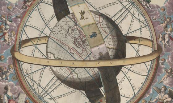
Into the cosmos
To begin, we’re heading out into the cosmos with the Schevenhuysen Map: a rare, hand-coloured copperplate engraving printed in Haarlem at the end of the Dutch Golden Age by Ambrosius Schevenhuysen.
This spectacular cosmographical map depicts Earth in circular layers with Hell at its core. It includes miners, comets, war, lightning, rainbows, the sky, the sea and more.
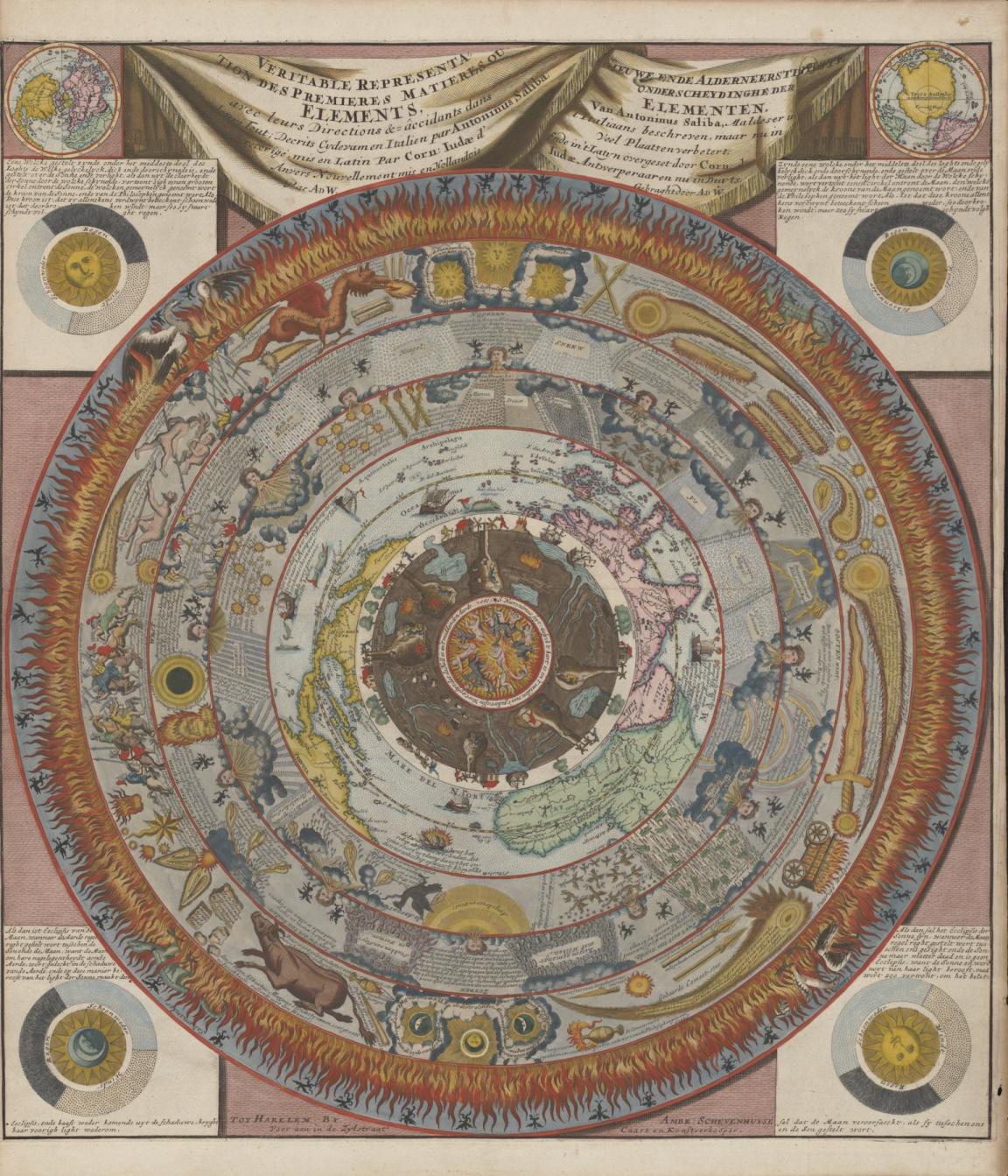
Ambrosius Schevenhuysen, Veritable Representation des Premieres Matieres ou Elements (True Representation of the First Matters or Elements), c. 1700, nla.gov.au/nla.obj-3086508917
Ambrosius Schevenhuysen, Veritable Representation des Premieres Matieres ou Elements (True Representation of the First Matters or Elements), c. 1700, nla.gov.au/nla.obj-3086508917
The whole world in the palm of your hand
Measuring at just 8.3cm in diameter is Cary's pocket globe agreeable to the latest discoveries, one of many “pocket globes” in the Library’s collection. First created over 200 years ago, these small globes, often between 7-8cm, were intended to be used as teaching aids, conversation starters and when discussing the latest explorations overseas. This globe, like many others, was kept in a sharkskin ‘shell’ that would protect it when being carried in pockets or purses.
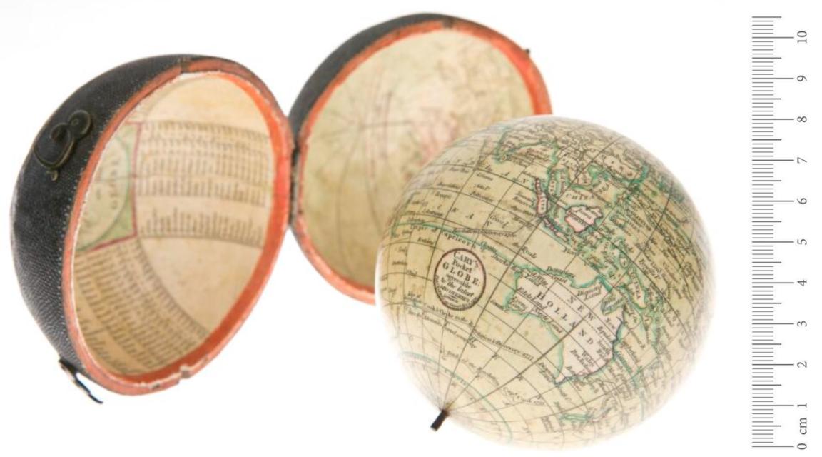
John Cary, William Cary and Jean Baptiste Bourguignon d'Anville, Cary's pocket globe agreeable to the latest discoveries, 1791, nla.gov.au/nla.obj-234207821
John Cary, William Cary and Jean Baptiste Bourguignon d'Anville, Cary's pocket globe agreeable to the latest discoveries, 1791, nla.gov.au/nla.obj-234207821
A beau-tea-ful globe
Just above the standard size for a pocket globe is this pewter Chinese tea caddy globe made during the late Qing/early Republic period. At 10cm in diameter, and almost double that when accounting for the stand, this globe may not fit in your pocket, but it’s a great spot for keeping loose leaf tea. According to Chinese tradition, pewter was thought to eliminate metallic overtones in your favourite brew.
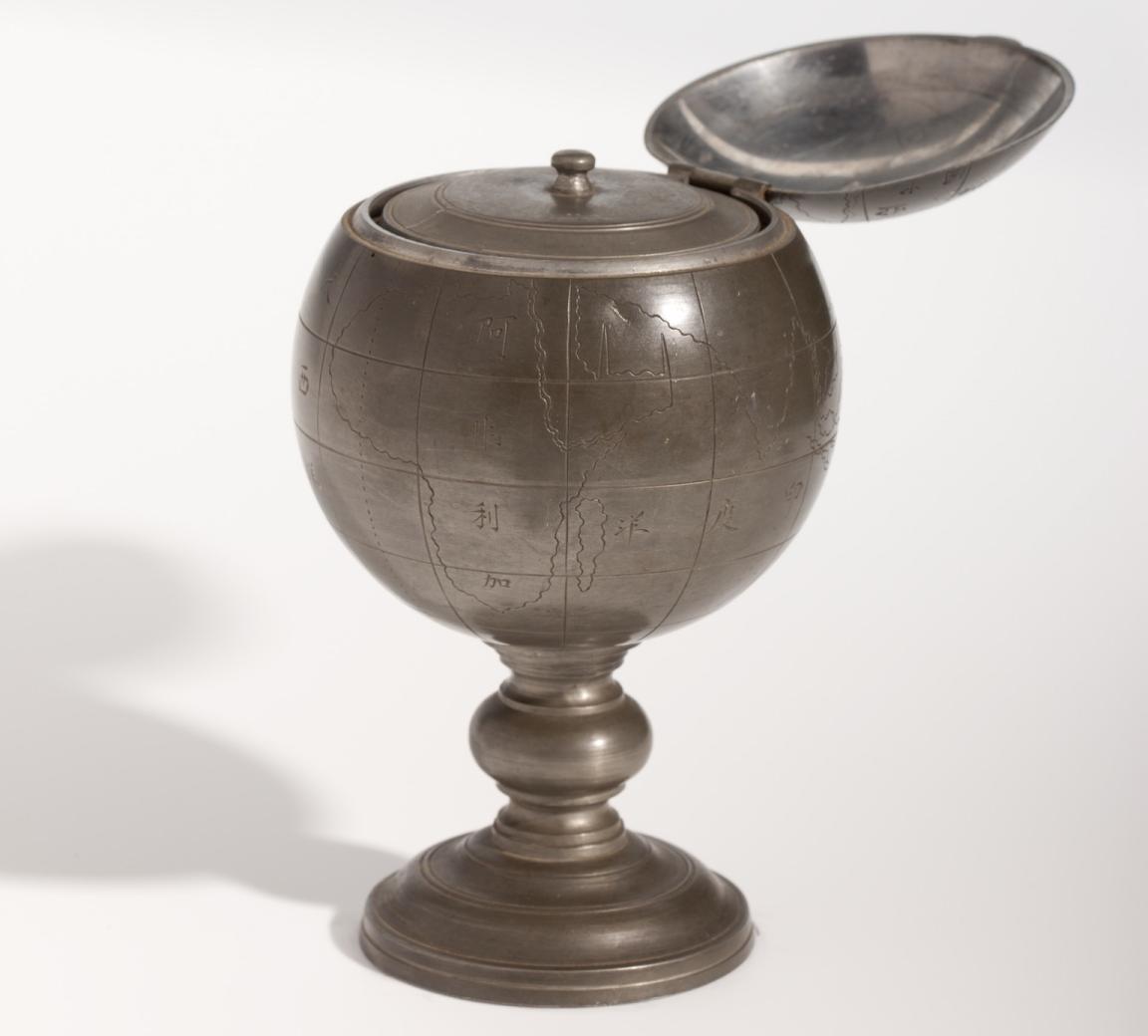
Lonkee, [Chinese tea caddy globe], c.1860, nla.gov.au/nla.obj-234307080
Lonkee, [Chinese tea caddy globe], c.1860, nla.gov.au/nla.obj-234307080
Globetrotting gastronomy
Foods and drinks, such as tea, are also the subject of many maps. For example, you can learn about the history and value of tea in this map entitled ‘Tea revives the world’.
Or, visit one of the most famous countries in the world for food and wine and check out the Carte gastronomique de la France (Gastronomic map of France). In this map, you can learn about wine and beer production, crops and local specialties around the country.
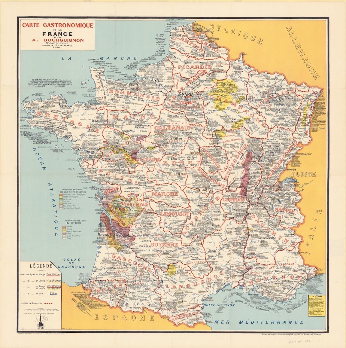
André Bourguignon, Carte gastronomique de la France, 1951, nla.gov.au/nla.obj-234055736
André Bourguignon, Carte gastronomique de la France, 1951, nla.gov.au/nla.obj-234055736
1920s Australia
Moving back home to maps of Australia, there is much to be seen in the New Oxford Wall Maps of Australia. Showing the distribution of things such as population, cattle and minerals, sheep and wheat and vegetation across the country as they were in the 1920s, these fascinating maps are a great point of comparison to today.
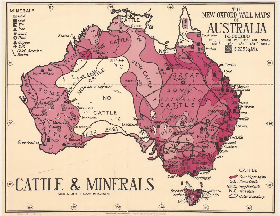
Thomas Griffith Taylor and H. O. Beckit, The new Oxford wall maps of Australia, c.1920, nla.gov.au/nla.obj-255201355
Thomas Griffith Taylor and H. O. Beckit, The new Oxford wall maps of Australia, c.1920, nla.gov.au/nla.obj-255201355
Finding farms
Speaking of sheep and cattle, pastoral maps are a great resource for family historians who know of family members who worked on or owned livestock farms. You might not notice at first glance, but they also often contain indexes to series mapping. In the pastoral map below of Western Australia, you can see the index for the 300 chain cadastral series, which are available to view online in Trove.
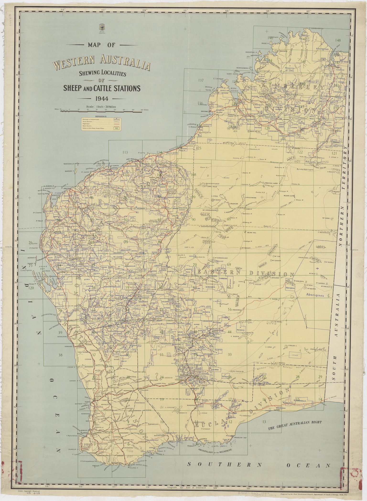
Chief Draftsman's Branch, Dept. of Lands and Surveys, Perth W.A, Map of Western Australia shewing localities of sheep and cattle stations 1944, nla.gov.au/nla.obj-1282170174
Where will our maps take you?
This only scratched the surface of our maps collection; explore more through the catalogue.
Not sure where to start but keen to learn about how you can find and use maps in the Library’s collection? Check out our research guides about Australian maps for family historians, Australian topographic maps, British and Irish maps for family historians, and overseas series mapping.
More to explore
J. van. Loon & Andreas Cellarius, Sitvs terrae circvlis coelestibvs circvndatae, 1660, nla.gov.au/nla.obj-230714394

Lucas Janszoon Waghenaer, Afconterfeytinge van die strate oft engde van Sunda, tusschen Sumatra en Iava in Oost Indien, als oock die baye oft rede voor Bantam die hooft-stadt van Iava, tesamen met alle hare eylanden, clippen, ondiepten en sanden, alles nae t' leven net afgetogen, c.1602, nla.gov.au/nla.obj-3444422116
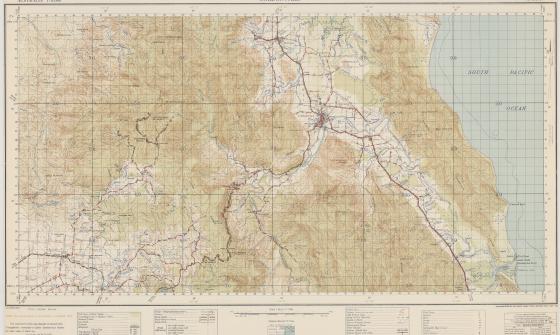
Australia. Army. Topographical Survey Company, 2/1st & Australia. Army. Topographical Survey Company, 6th & Australia. Army. Royal Australian Survey Corps. Gordonvale, Queensland Topographical Survey Company, 1942, nla.gov.au/nla.obj-234344829

Visit us
Find our opening times, get directions, join a tour, or dine and shop with us.