Aerial photographs collection
Collection highlights
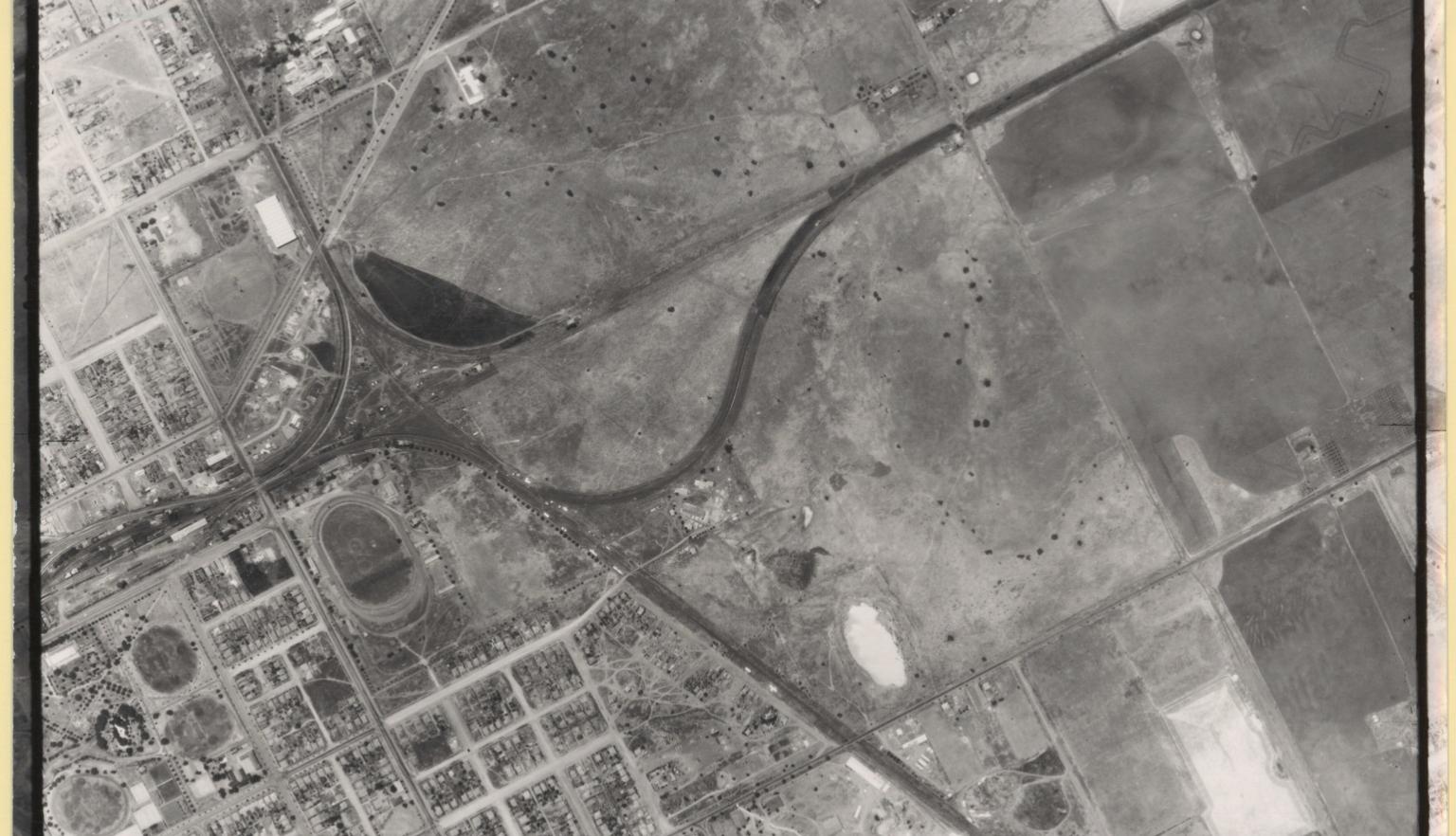
Dubbo Stores deport, 1952, nla.gov.au/nla.obj-233940651
Dubbo Stores deport, 1952, nla.gov.au/nla.obj-233940651
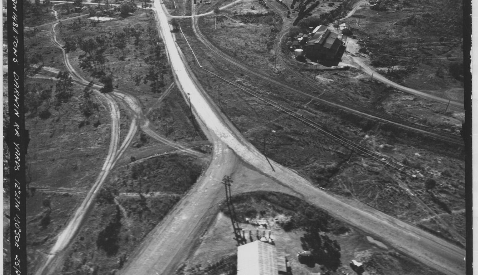
Darwin RR Yards, 1952, nla.gov.au/nla.obj-743536816
Darwin RR Yards, 1952, nla.gov.au/nla.obj-743536816
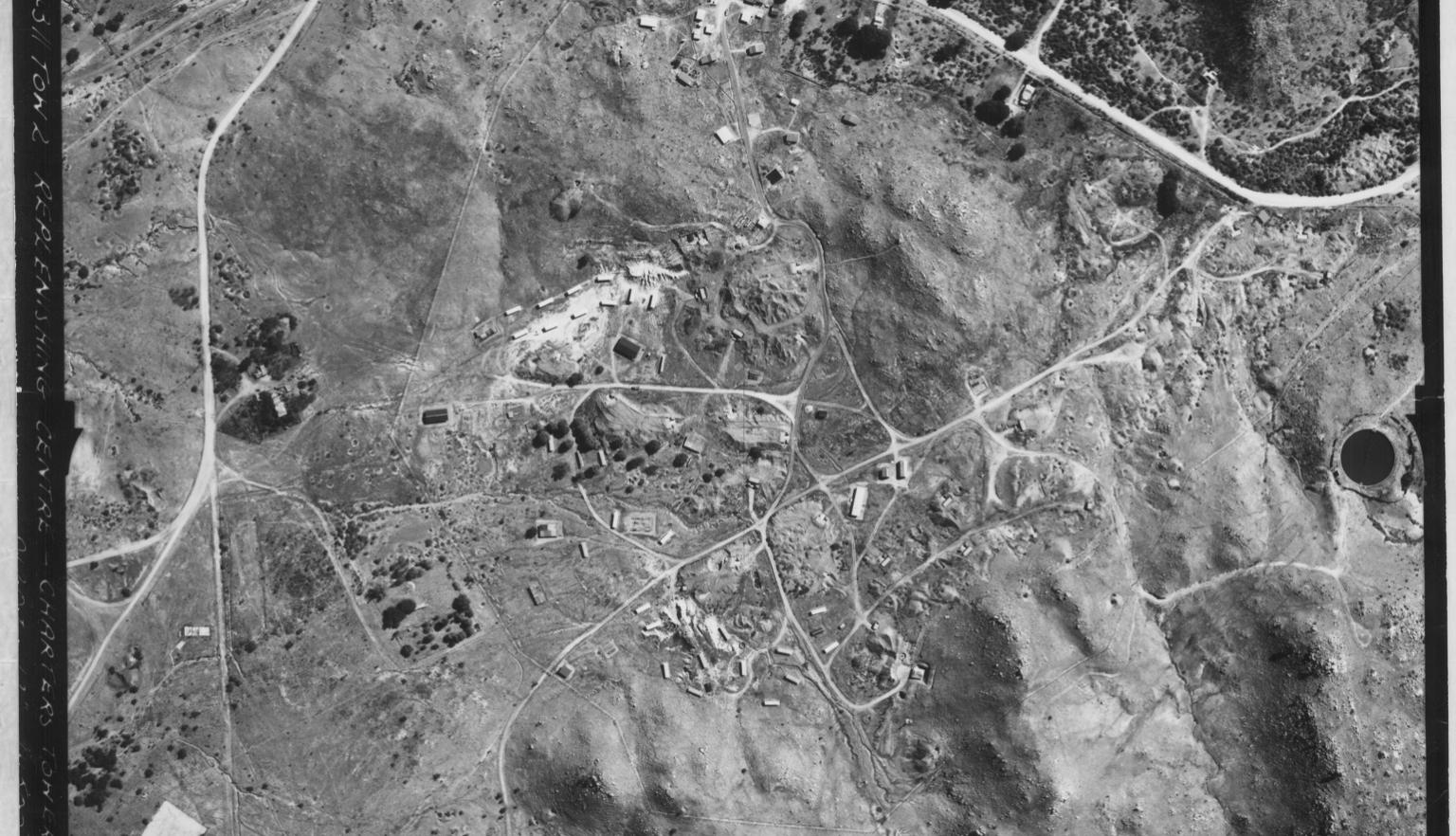
Charters Towers Replenishing Centre, 1952, nla.gov.au/nla.obj-2909430463
Charters Towers Replenishing Centre, 1952, nla.gov.au/nla.obj-2909430463
About aerial photography in Australia
In 1924, aerial photographs of the Great Barrier Reef were taken for the Australian Army to assist with topographical mapping. The Royal Australian Air Force (RAAF) got involved in aerial photography in 1928, and by the following year, they began conducting air surveys to provide the Australian Survey Corps with photos of coastal areas south of Sydney. By the mid-1930s, aerial photography had replaced plane tabling as the primary method for creating topographical maps in Australia, leading to the formation of the RAAF Communication and Survey Flight in 1937.
World War II developments
When World War II broke out, only a small part of Australia had been mapped topographically. Many settled areas were photographed during the war, and in 1947, the RAAF was tasked with progressively photographing northern and inland Australia. Using Mosquito planes flying at 25,000 feet, they captured 328,000 square miles of land in 1947-48. By 1952, they had systematically covered about 1.25 million square miles of northern and central Australia. However, the 87 (Photographic Reconnaissance) Squadron was disbanded in 1953 due to financial constraints.
Post-War mapping efforts
In 1954, the National Mapping Section was transferred from the Royal Australian Survey Corps to the Department of the Interior. From the mid-1950s, both the Royal Australian Survey Corps and the Division of National Mapping shared responsibility for national topographical mapping and aerial photography. The Survey Corps focused on northern Australia and Papua New Guinea, while the Division of National Mapping operated in the more settled southern regions. As the RAAF withdrew, the Division relied on commercial airlines like Adastra Airways for aerial photographs.
Completion of map coverage
By 1966, aerial photography had completed map coverage of Australia, with the exception of a small part of Cape York Peninsula. The Survey Corps and the Division of National Mapping published a total of 540 sheets in the 1:250,000 scale (four miles to one inch). After 1966, the Commonwealth agencies shifted their focus to producing maps in the 1:100,000 scale.
Background to the collection
In 1963, we received a large collection of Australian aerial photographs, taken between 1928 and around 1953. These photos came from the Central Photographic Establishment of the RAAF in Laverton, Victoria, thanks to a suggestion from the Division of National Mapping. Throughout the 1980s, smaller groups of aerial photographs were added from the RAAF, the Division of National Mapping, and CSIRO. From 1991 to 1995, we received even more aerial photos from the Australian Land Information and Survey Group (AUSLIG), which had taken over from the Division of National Mapping; these photos mostly date from 1953 to 1987.
In 1998, AUSLIG donated the SCAR (Scientific Committee on Antarctic Research) collection of Antarctic aerial photographs, along with a collection of aerial photos of Indonesia. Additionally, in 2003, the Research School of Pacific and Asian Studies at the Australian National University donated a collection of aerial photographs of Papua New Guinea that had previously been held by CSIRO.
The aerial photographs collection is located in the Maps Collection. The Australian vertical photographs are organised by the 1:63,360 topographic map series sheet numbers (one inch to a mile), ranging from C48 (Christmas Island) to K55 (Tasmania). This means that photos of the same area taken at different times are kept together. The oblique photographs are sorted by state and then alphabetically by place name. The Papua New Guinea photographs are arranged by the 1:250,000 topographic map series sheet numbers, while the Antarctic photographs are organised by year and then by geographical area or the 1:250,000 topographic map sheet numbers.
Australian and Papua New Guinea photographs are catalogued by place name and year, with entries that can describe a single photograph or several hundred. These entries include details like flight dates, flight numbers, run numbers, and print ranges, and may reference related flight diagrams. However, the Australian oblique and Antarctic photographs have not yet been catalogued.
The Australian flight diagrams are available in the Maps Reading Room, either on microfiche or in binders, and are also organised by the 1:63,360 topographic map series sheet numbers. Additional flight diagrams can be accessed online.
A comprehensive collection of Australian aerial photographs is held in the National Archives of Australia in Canberra.
This guide was prepared using these references:
- CD Coulthard-Clark, Australia’s military map-makers: the Royal Australian Survey Corps 1915-96, Melbourne, Oxford University Press, 2000
- John D Lines, Australia on paper: the story of Australian mapping, Melbourne, Fortune Publications, 1992
- Maura O’Connor, ‘Aerial photograph collections in Australia’, Australian surveyor, vol. 37 (4), Dec. 1992, pp. 263-69
- Maura O’Connor, ‘Arrangement of aerial photographs in the National Library of Australia’, Information bulletin (Western Association of Map Libraries), vol. 28 (2), March 1997, pp. 70-76
Continue your journey


More to explore