Federation: Maps
Maps collection
Our collection of maps and atlases contains some interesting items which can help provide context and background to Federation.
Much of the maps collection is currently uncatalogued, so readers are advised to contact staff via our Ask a Librarian service for assistance in identifying and requesting material.
Digitisation of our collection is ongoing.
A map prepared for the Federal Convention of 1897 when the inclusion of New Zealand into the new Commonwealth was under consideration.
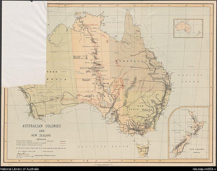
New South Wales. Government Printing Office. (1897). Australian colonies and New Zealand, nla.gov.au/nla.obj-231319653
New South Wales. Government Printing Office. (1897). Australian colonies and New Zealand, nla.gov.au/nla.obj-231319653
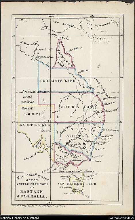
John Dunmore Lang, (1857), Map of the proposed seven united provinces of eastern Australia, nla.gov.au/nla.obj-232290542
Catalogue search tips
Pre and post Federation mapping can be found online and in the print collection. Use the Catalogue option and search for the name of the colony (e.g. Victoria) or Australia.
In the results list, under Limit your search, limit the Format to Maps. A year range limit is also available, so you can limit your results to maps published during the Federation years.
The publisher's name, e.g. H.E.C. Robinson, is also useful for searching for map material.
Early proposal for a United Australia
Discussion on uniting the disparate colonies was active throughout the nineteenth century. This map by John Dunmore Lang in 1857 proposes the Seven United Provinces of Eastern Australia .
The first official topographic map of the Commonwealth of Australia (PDF,617 KB) was published by the Australian government 1912 and called the Map of the Commonwealth of Australia. This map was published in eight sheets at a scale of 1:2,027,520. The Library holds four of these sheets.
Digitised Australian newspapers on Trove contain a number of articles on the progress of this early co-operative venture between the states over the years leading to publication. An interesting article on the history of the project can be found in The Clarence and Richmond Examiner of 27 January 1912.
Upon receipt of the map at the Royal Geographical Society it was described as having ' ... no great merit as a cartographical production, but will be very useful for reference.' The geographical journal, Vol. 43, no. 1, (Jan. 1914) p. 111.
New South Wales. Department of Lands & Vale, R.W & Black, J. M & Robinson, W. J & Miller, G & Bolton, F. C & Vautin, E. S. (Ernest Stafford), 1856-. (1912). Map of the Commonwealth of Australia / compiled, drawn, and printed for the Commonwealth Government at the Department of Lands, Sydney, N.S.W. ... ; compiled by R.W. Vale assisted by J.M. Black : the drawing and writing by R.W. Vale, J.M. Black, W.J. Robinson, G. Miller and F.C. Bolton, under the supervision of E.S. Vautin, Chief Draftsman, 5th November 1912. nla.gov.au/nla.obj-234426912
New South Wales. Department of Lands & Vale, R.W & Black, J. M & Robinson, W. J & Miller, G & Bolton, F. C & Vautin, E. S. (Ernest Stafford), 1856-. (1912). Map of the Commonwealth of Australia / compiled, drawn, and printed for the Commonwealth Government at the Department of Lands, Sydney, N.S.W. ... ; compiled by R.W. Vale assisted by J.M. Black : the drawing and writing by R.W. Vale, J.M. Black, W.J. Robinson, G. Miller and F.C. Bolton, under the supervision of E.S. Vautin, Chief Draftsman, 5th November 1912. nla.gov.au/nla.obj-234426912
Also in this guide
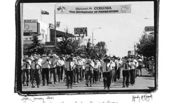
Wendy McDougall, Federation Parade walks proud along Sanger St. Corowa, 28th January 2001, nla.gov.au/nla.obj-146228696
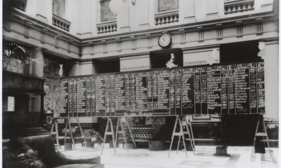
Australian Federation Referendum Results 1899, nla.gov.au/nla.obj-136434299
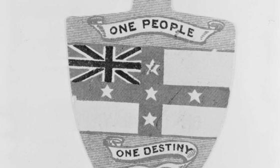
Badge of the Australia Federation League of New South Wales, ca. 1900, between 1898 and 1901, nla.gov.au/nla.obj-143365932
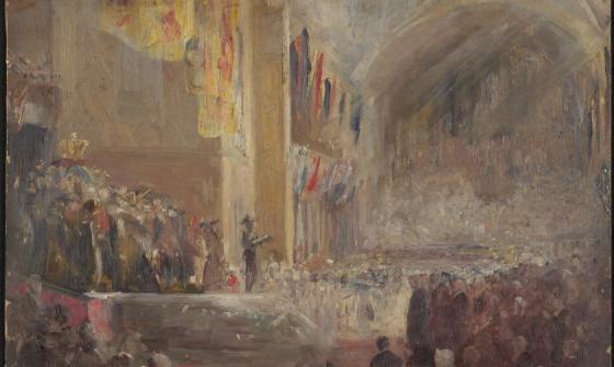
Tom Roberts, Sketch for opening of Federal Parliament, 1901, nla.gov.au/nla.obj-134312660