First World War: Maps and atlases
Our collection of maps and atlases contains some important items which can help provide context and background to First World War research. Much of the maps collection is currently uncatalogued, so readers are advised to contact staff via our Ask a Librarian service for assistance in identifying and requesting material. Digitisation of our collection of First World War maps is ongoing.
Catalogue search tips
Subject headings which can be used to find First World War maps in our catalogue include:
- World War, 1914-1918 - Campaigns - Turkey - Gallipoli Peninsula - Maps
- World War, 1914-1918 - Campaigns - Palestine - Maps
- World War, 1914-1918 - Maps
- World War, 1914-1918 - Europe - Maps
- Australia - History, Military - Maps
Keywords such as the following can also be used:
- 'dardanelles maps'
- 'somme maps'
Use the ‘Limit your search’ options to the right of the catalogue search results to narrow your results by 'format' to maps material.
Many maps in our collection remain uncatalogued and readers are advised to contact us if they cannot locate particular items.
Commercial war maps
Many maps were produced as supplements to newspapers and these provide a valuable insight into the way the progress of the war was viewed and experienced on the home front. Examples of this type of map published in both Europe and Australia are held by the Library, for example:
- What Germany wants: her claims as set forth by leaders of German thought
Call number: MAP G3201.S65 1916 - War map
Call number: MAP G5701.S65 [1914-1916?] - The Daily Mail bird's eye map of the British Front
Call number: MAP G5831.s65 [1916-1918]
Supporting material
There are various titles held by the Library which can be used to support research into First World War mapping. Titles may be held in the Main Reading Room Reference Collection or in the book stacks and are available for requesting via the online catalogue.
- An atlas of Australia's wars
Call number: RF 355.00994 C652-2 - Pilgrimage : a traveller's guide to Australia's battlefields
Call number: RF 355.4 H976 - Topography of Armageddon : a British trench map atlas of the western front, 1914-1918
Call number: YYef 2014-583 - Artillerys astrologers: a history of British survey and mapping on the Western Front 1914-1918
Call number: YYq 2014-911 - The Imperial War Museum Trench Map Archive on CD-ROM
Call number: MAP mt 411
Featured resource: Where are our boys?
A fascinating history of the First World War newsmaps, produced to explain the progress of the war to the families left at home in Australia.
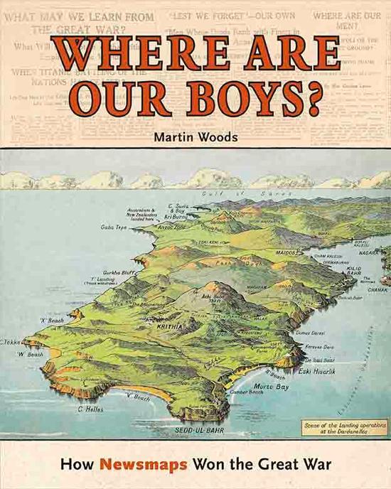
Martin P. Woods, & National Library of Australia, Where are our boys? : how newsmaps won the Great War, 2016, nla.gov.au/nla.cat-vn6972381
Martin P. Woods, & National Library of Australia, Where are our boys? : how newsmaps won the Great War, 2016, nla.gov.au/nla.cat-vn6972381
National Library map collections
Ernest Keith White fought with the Australian Imperial Force at Pozieres and Strazeele. His collection contains aerial photography and maps of World War I battle zones and front lines in France in 1917, as well as trench and enemy location maps. Uncatalogued.
Cyril Sydney Hertz was an avid collector of books, maps and documents relating to military and aviation history. The map collection contains 35 maps (76 sheets) mostly dating from World War I. It is particularly strong in the area around Ypres in Belgium and also has good maps of Anzac Cove and the Dardanelles. There are also maps of German aircraft raids in England in 1915–17. Many of the maps were used in the field and contain manuscript annotations.
Edgeworth David was a geologist and a Major in the Australian Tunnelling Battalion. This collection contains unique engineering maps used for the design and siting of trenches and tunnels on the Western Front. Fully digitised.
Featured resource: Recruiting map of South Australia
This map was published for the World War I recruitment drive of 1916, to reinforce "the 10th, & 27th and 32nd Battalions already at the Front."
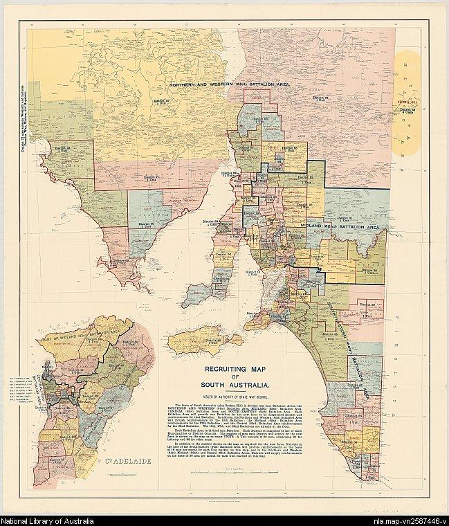
South Australia. State War Council. Recruiting map of South Australia, 1916, nla.gov.au/nla.obj-233496763
South Australia. State War Council. Recruiting map of South Australia, 1916, nla.gov.au/nla.obj-233496763
Featured resource: Trench maps
A trench map is a graphic depiction of military movements undertaken during trench warfare. The National Library holds a good collection of First World War trench maps at various scales. Although mainly British, there is also a small collection of French and German trench maps.
Although covering the main theatres of war in Europe, France and Belgium there is some coverage of Gallipoli and Palestine.
Also see: British Army WW1 Trench Maps
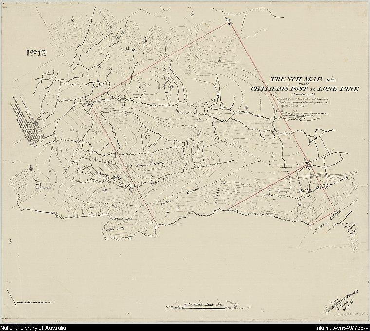
Great Britain. Army. Mediterranean Expeditionary Force, Trench map from Chatham's Post to Lone Pine, no. 12, 1915, nla.gov.au/nla.obj-2972839942
Great Britain. Army. Mediterranean Expeditionary Force, Trench map from Chatham's Post to Lone Pine, no. 12, 1915, nla.gov.au/nla.obj-2972839942
Also in this guide
[Anzacs and Anzac Day 1915 - 1919 : programs and invitations ephemera material collected by the National Library of Australia], nla.gov.au/nla.obj-54675381
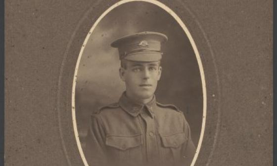
James Charles Cruden, Portrait of a young soldier, Sydney, approximately 1915, nla.gov.au/nla.obj-152950669
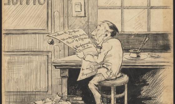
Boz, Billy Hughes reading a document in his War Office, nla.gov.au/nla.obj-138221960

Britannica Australia Awards Literature medal, 1964, awarded to Judith Wright, nla.gov.au/nla.obj-143523448